Quick Facts
Quick Facts
Snow, sleet, and freezing rain all start out as snowflakes in the clouds.
Whether it stays snow or turns to ice depends entirely on the temperature of the air it falls through.
A warm nose of air just 500 feet thick can turn a foot of snow into a quarter-inch of devastating ice.
Meteorologists use weather balloons to measure these temperatures, but balloons are launched only twice a day and can miss tiny warm layers.
Visual answer
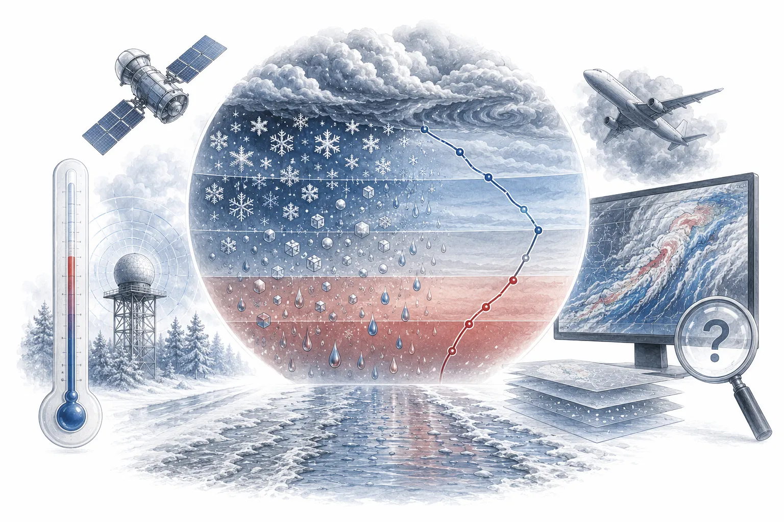
The Temperature Layers That Create Wintry Mix
How a tiny warm layer changes everything.
Snow
Whole atmosphere is below freezing. Snow stays snow.
Sleet
Warm layer melts snow into rain. Cold layer refreezes it into ice pellets.
Freezing Rain
Warm layer melts snow into rain. Cold layer is thin. Rain freezes on contact.
Rain
Warm layer is thick and reaches the ground. Rain stays liquid.
Story in brief
Story in Brief
1940s
Meteorologists first use weather balloons to measure upper atmosphere temperatures.
They discover that winter storms often have complex temperature layers that determine precipitation type.
1990s
Doppler radar and computer models improve, but wintry mix remains the hardest forecast.
Scientists realize that tiny temperature variations, not storm intensity, determine snow vs. ice.
2020s
AI and high-resolution models reduce errors but still struggle with the 33°F threshold.
Wintry mix remains the meteorologist's nightmare because the atmosphere is still chaotic at microscopic scales.
The Temperature Cake
An Atmospheric Layer Cake
To understand why wintry mix is a nightmare, you have to think of the sky as a layer cake. For it to snow, the whole cake needs to be freezing. Snow falls from the cold clouds, passes through the cold air, and lands on the cold ground.
But winter storms are messy. Often, they drag in a wedge of warm air from the south. This warm air slides over the dense, freezing air at the ground. Now your layer cake has a warm filling in the middle.
If a snowflake falls through that warm layer, it melts into a raindrop. If the ground layer is freezing, that raindrop has to figure out what to do. Does it freeze in the air (sleet)? Does it stay liquid until it hits a tree branch and freezes instantly (freezing rain)? That depends on how thick the warm layer is, and how deep the cold layer is. It is an absurdly delicate balance.
The Margin
The Margin of Error
Computer weather models are incredibly advanced, but they still make mistakes. If a model predicts the warm layer will be 34°F, but it is actually 32°F, you get snow. If it predicts 32°F but it is actually 34°F, you get rain.
A two-degree error is invisible to humans, but it completely changes the physical state of water falling from the sky. That is why your weather app says 'wintry mix' instead of telling you exactly what will happen. It is not a cop-out. It is an admission of humility.
The atmosphere does not care about our models. It operates on invisible, microscopic thresholds that we can only estimate. Wintry mix is a reminder that nature is still more complex than our computers.
From the Field
"I can tell you exactly where a hurricane will make landfall a week out. But I cannot tell you if you'll get snow or ice tomorrow morning. That is the wild west of forecasting."
, Anonymous meteorologist
This is a common refrain among forecasters. Wintry mix is the hardest forecast because it depends on microscopic temperature variations.
Evidence
What Makes It So Hard
The 33°F threshold is incredibly sensitive. A 1°F difference changes precipitation type.
StrongWeather balloons are launched only twice a day and can miss tiny warm layers.
StrongComputer models have a resolution of 1-2 miles, but warm layers can be 500 feet thick.
StrongGround-level conditions like pavement temperature also affect whether rain freezes.
ModerateKey Points
Key Points So Far
Wintry mix depends on microscopic temperature changes in the atmosphere.
It requires a 'warm wedge' of air sliding over freezing ground air.
Snow turns to sleet or freezing rain depending on the thickness of that warm wedge.
Weather models are often off by just 1-2 degrees, which completely changes the forecast.
The atmosphere is still more complex than our computers can handle.
Analogy
Like Boiling Water
The familiar part
Imagine you are watching a pot of water. You know it will boil soon. But you cannot predict the exact millisecond it will start bubbling. It is close. It is inevitable. But the exact moment is chaos.
How it applies
That is wintry mix. Meteorologists know it will precipitate. They know the temperature is close to freezing. But they cannot predict exactly what form it will take. The atmosphere is the pot of water. The moment of freezing is the boil.
Where the analogy breaks
Boiling water is binary. It boils or it does not. Wintry mix has four outcomes: snow, sleet, freezing rain, or rain. The analogy captures the uncertainty, not the complexity.
Curiosity Notes
Details Most People Miss
Why this still matters
Why This Still Matters
Wintry mix is not just a weather trivia question. It is a safety issue. Ice storms are among the most dangerous winter events. They knock out power. They cause car accidents. They kill people. Predicting wintry mix correctly saves lives. That is why meteorologists keep trying. That is why we keep asking.
Key Findings
- ✓Core findingWintry mix depends on microscopic temperature changes in the atmosphere.
- ✓Strong evidenceIt requires a 'warm wedge' of air sliding over freezing ground air.
- ⚠Main consequenceSnow turns to sleet or freezing rain depending on the thickness of that warm wedge.
- ✓Wider legacyWeather models are often off by just 1-2 degrees, which completely changes the forecast.
- ★Bottom lineThe atmosphere is still more complex than our computers can handle.
Final insight
A Last Thought
Wintry mix is hard to predict because the atmosphere is messy. It does not care about our models. It does not care about our deadlines. It operates on invisible thresholds that we can only estimate. A hurricane is a giant, obvious beast. A warm wedge of air is a ghost. We are hunting ghosts. And sometimes, the ghosts win. That is why your weather app says 'wintry mix.' It is not a cop-out. It is an honest admission of the limits of human knowledge.
Quick answers
Common questions
Why can't they just use radar to predict wintry mix? +
Radar shows precipitation, not temperature. It cannot tell if the rain will freeze or stay liquid. Doppler radar is incredible at tracking storms, but it is blind to the temperature layers that determine precipitation type.
How do meteorologists measure the temperature layers? +
They launch weather balloons twice a day. The balloons carry instruments called radiosondes that measure temperature, humidity, and pressure as they rise. But balloons only go up twice a day, and tiny warm layers can form and disappear between launches.